Santana do Araguaia
Santana do Araguaia is a city in Brazil with a population of about 32,413.
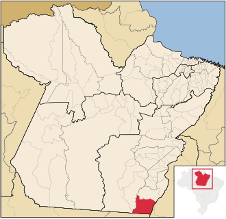
Santana do Araguaia is the southernmost city in the Brazilian state of Pará. The city lies near the Araguaia River, which marks the border with the state of Tocantins and Mato Grosso. The town was established on December 20, 1961, by then-governor of Pará, Aurélio do Carmo, after being split off from the municipality of Conceição do Araguaia.
🌦️ Live weather & local time
Loading live conditions…
About Santana do Araguaia
| Country | Brazil |
| Continent | South America |
| Explore | 16 |
| Population | 32,413 |
| Local currency | BRL |
| Coordinates | -9.3350, -50.3500 |
| Time zone | America/Belem |
🧭 Facts & curiosities
| Settlement type | Town |
| Distance to the capital | 763 km · Brasilia |
| Population (Brazil) | #1153 most populated in Brazil |
| Where on Earth | 9°20′6″S · 50°21′0″W |
| Hemisphere | S · W |
| Distance to the equator | 1,039 km |
| Distance to the South Pole | 8,980 km |
| Did you know | More populous than 100% of all places |
| Same latitude as | Calumbo (Angola) |
| Antipode (other side of Earth) | 9.34, 129.65 |
✈️ Distance to major cities
| São Paulo | 1,630 km |
| New York | 6,071 km |
| Paris | 8,257 km |
| London | 8,292 km |
| Los Angeles | 8,615 km |
| Cairo | 9,729 km |